Staying safe on a hike requires more than carrying a charged phone. Before leaving, check the route and weather, share a detailed itinerary, download offline maps, pack emergency supplies, and choose a reliable backup for areas without cellular coverage. On the trail, keep the group together, monitor daylight and conditions, and turn back before a delay becomes an emergency.
Your phone can support navigation, check-ins, lighting, and communication, but it should be one part of a wider safety system. A dependable plan also includes suitable clothing, physical maps, practiced navigation skills, emergency equipment, and clear decisions about when to stop or request help.
Prepare for the Trail Before You Leave
Preparation reduces the number of decisions you must make when you are tired, cold, behind schedule, or unable to access the internet. Build the plan around the specific trail instead of relying only on general hiking experience.
Check the Route, Weather, and Daylight
Review the trail's distance, elevation gain, junctions, exposed sections, water crossings, and possible turnaround points. Check the official park or land-management website for closures, permits, fire restrictions, and current trail conditions.
Weather at the trailhead may differ from conditions at higher elevations. Review the forecast for the route rather than the nearest city, and pay attention to thunderstorms, extreme heat, snow, wind, and heavy rain. Check the forecast again shortly before departure.
Estimate the hiking time using the pace of the slowest group member. Add time for breaks, route checks, difficult terrain, and unexpected delays. Compare the estimate with sunset and carry a headlamp even when you expect to finish in daylight.
Share Your Itinerary and Set a Turnaround Time
Give your itinerary to a trusted person who is not joining the hike. The plan should contain:
- The trail, trailhead, route, and intended destination
- Your vehicle description and parking location
- The names and phone numbers of group members
- Your departure, turnaround, and expected return times
- The communication and emergency devices being carried
- Instructions for when and how to contact authorities
The National Park Service advises hikers to tell someone where they are going and when they expect to return. Its Yosemite wilderness safety guidance also notes that rangers do not routinely track overdue hikers.
Set a firm turnaround time before starting. This is the latest time the group will continue forward, regardless of how close the summit or destination appears. Notify your contact when you return so they do not initiate an unnecessary response.
Pack the Safety Essentials You May Need
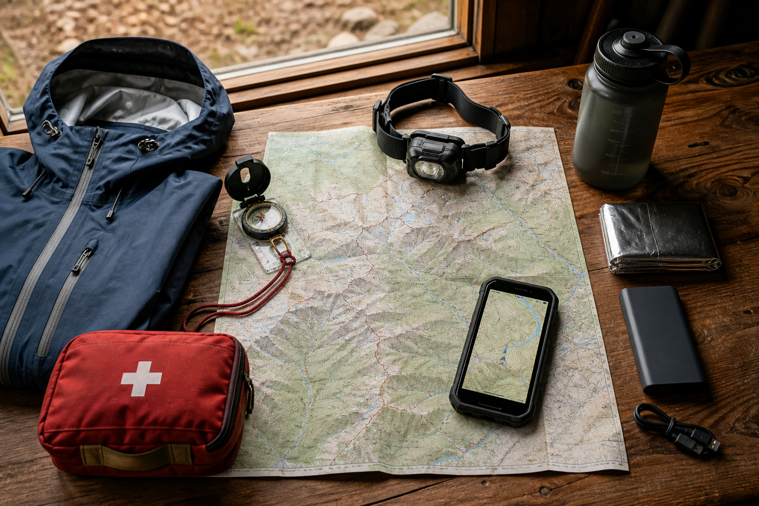
Pack for an unexpected delay rather than only for the planned duration. The National Park Service Ten Essentials organizes essential gear into navigation, sun protection, insulation, illumination, first aid, fire, repair tools, food, hydration, and emergency shelter.
Use the following checklist as a starting point:
| Safety need | Recommended equipment |
|---|---|
| Navigation | Offline map, physical map, compass, and GPS-capable device |
| Communication | Charged phone and a remote-area emergency backup |
| Weather protection | Insulating layer, waterproof shell, hat, and gloves |
| Illumination | Headlamp with spare batteries |
| First aid | First-aid kit, personal medication, and emergency information |
| Unexpected delay | Extra food, water treatment, and emergency shelter |
Adjust the list for the route, season, group, and expected hazards. Test unfamiliar equipment before the trip. A compass, satellite messenger, or water filter provides little value if you do not know how to operate it under pressure.
For longer routes, inspect cables, charging equipment, and protective carrying options before leaving. The OUKITEL accessories collection can help users check compatible charging and carrying equipment for supported devices.
Stay Connected When the Trail Has Limited Signal
Cellular coverage may weaken gradually or disappear completely. GPS positioning can often continue without mobile service, but live map downloads, calls, messages, and location sharing may stop working. Prepare your information and communication plan while you still have a reliable connection.
Download Maps and Key Information for Offline Use
Download the entire route before leaving home, including a wider surrounding area in case you miss a junction. Put the phone in airplane mode and confirm that the maps still open and display your position.
Store offline copies or screenshots of:
- The trail map and route description
- Trailhead coordinates
- Important junctions and landmarks
- Turnaround and emergency exit points
- Local ranger and emergency contact details
- Permits and reservation information
- Medical details and emergency contacts
A paper map and compass remain important because phones can be damaged, lost, drained, or affected by software problems. OUKITEL's explanation of how GPS works in smartphones provides additional background on satellite positioning and conditions that may affect accuracy.
Do not assume that a location shown by an app proves you are on a safe trail. Compare the device reading with signs, terrain, landmarks, and your physical map.
Set Check-In Times and a Group Communication Plan
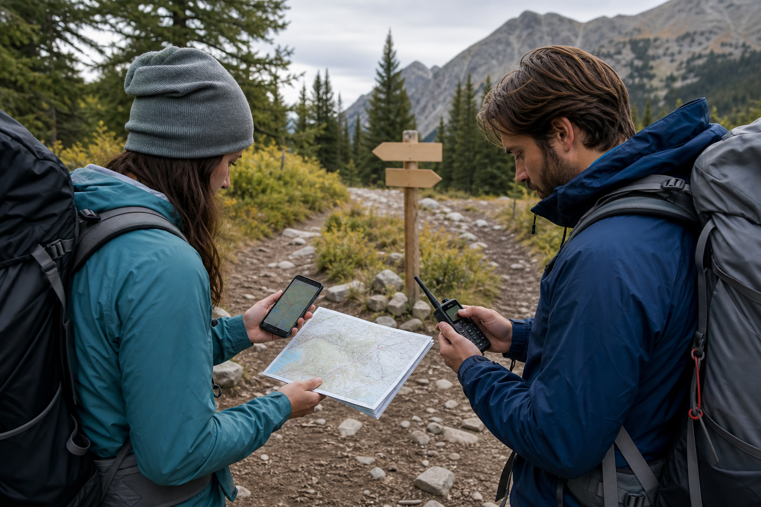
Choose check-in points that correspond to meaningful stages of the hike, such as reaching the trailhead, passing a major junction, turning around, and returning to the vehicle.
A useful update should include the location, time, group condition, and next action. For example: "Group safe at North Ridge Junction at 2:40 p.m. Turning back now; expected at the trailhead by 5:00 p.m."
Before starting, agree on:
- Who carries each communication device.
- Which phone numbers or radio channels the group will use.
- When each scheduled check-in should occur.
- Where separated hikers should stop and wait.
- What circumstances require emergency assistance.
Messages may remain pending until the phone briefly reconnects. Include the time and location in the message itself so the recipient can understand it even if delivery is delayed.
Carry an Emergency Backup for Remote Routes
A hiking group can become separated after a missed junction, sudden weather change, or difference in walking pace. In areas with weak cellular coverage, a trail phone is most useful when it keeps offline maps available, retains enough power for navigation and check-ins, and supports the group's planned communication method.
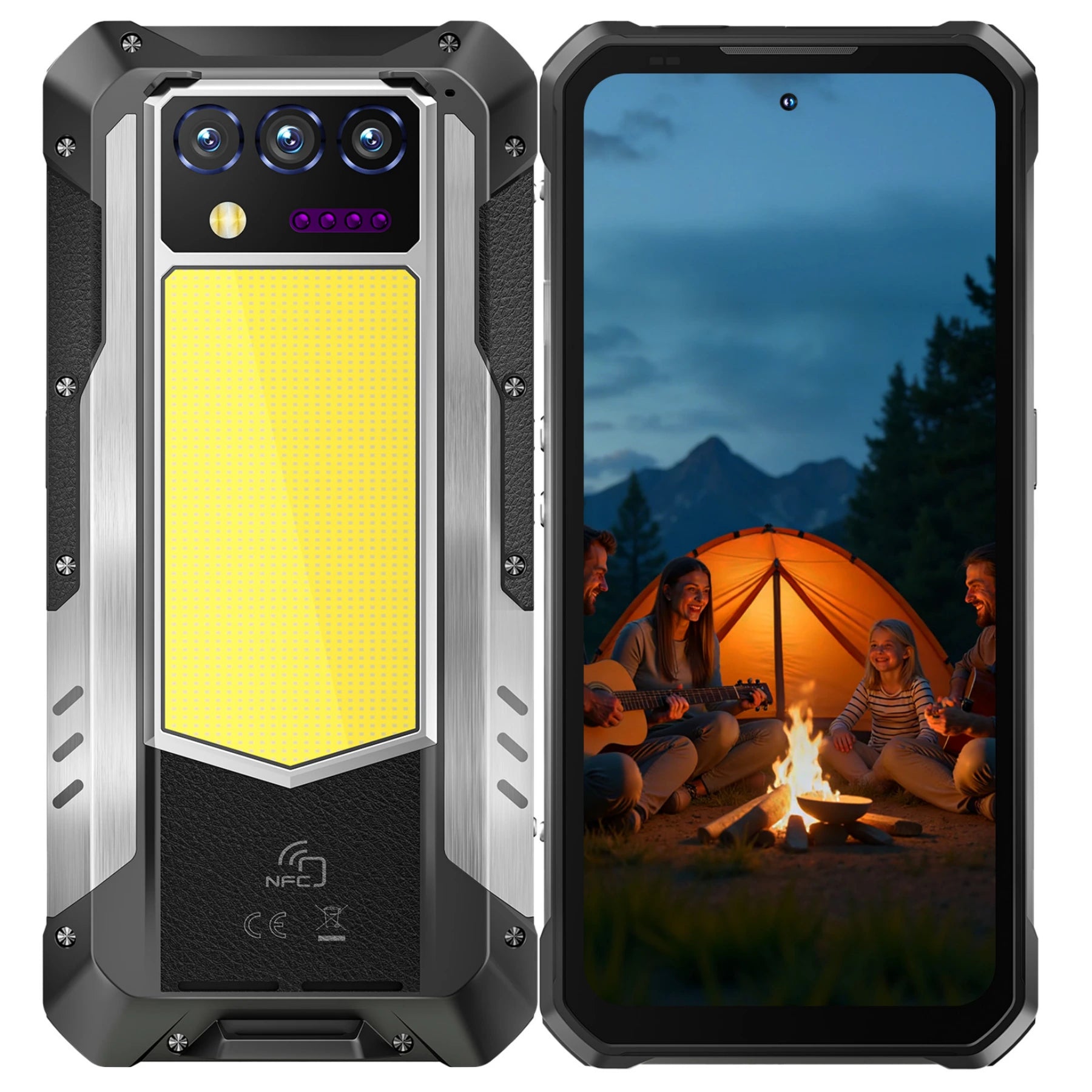
The OUKITEL WP61 Plus combines a 20,000mAh battery with a built-in 2W DMR walkie-talkie. Compatible DMR or analog devices configured to the same supported channel can communicate directly without relying on a cellular network. Its 1,200-lumen camping light may also help if a delayed return continues into low light.
These functions have important limits. Radio range varies with mountains, trees, elevation, interference, device configuration, and local regulations. The phone is also heavier than a conventional handset. It should support - not replace - offline navigation, a physical map, and a satellite messenger or personal locator beacon on remote routes.
Users comparing durability, battery size, and outdoor communication features can review the OUKITEL rugged phone collection and the practical criteria in the guide to buying a rugged phone. Confirm current specifications and regional compatibility before relying on any device.
Manage Changing Conditions While You Hike
A plan is useful only when it is compared with real conditions. Check your progress regularly instead of waiting until worsening weather or a major delay forces a decision.
Monitor Your Location, Pace, and Remaining Daylight
Confirm your position at junctions, after long climbs, and whenever the terrain no longer matches the route description. Brief, regular checks are more efficient than correcting a major navigation error.
Compare your actual pace with the schedule. If the group reaches a checkpoint late, shorten the route or turn around. Do not assume the return will be faster; fatigue, darkness, wet surfaces, an injury, or changing water levels may slow the group.
Protect communication power by:
- Reducing screen brightness
- Closing unneeded applications
- Using airplane mode when appropriate
- Keeping the phone insulated in cold weather
- Reserving power for maps and communication
- Carrying compatible backup power when necessary
Battery capacity does not guarantee a specific runtime. Screen use, navigation, weak-signal searching, temperature, lighting, and background applications all affect power consumption.
Keep the Group Together at Junctions and Rest Stops
Move at a pace the entire group can maintain. Stronger hikers should not continue so far ahead that visual or agreed communication contact is lost.
Wait for everyone at junctions, water crossings, rest points, and major changes in terrain. If the group must spread out, place experienced hikers at the front and rear.
Use fixed meeting instructions. "Wait at the marked north-trail junction" is safer than "keep going until you see us." Clear locations reduce the risk of separated hikers moving in different directions while searching for one another.
Turn Back When Weather, Energy, or Visibility Worsens
Turn back when the safety margin begins to shrink, not only after the situation becomes dangerous. Warning signs include:
- Progress that is substantially slower than planned
- Repeated uncertainty about the route
- Declining visibility or approaching thunderstorms
- Rising water or deteriorating trail conditions
- Insufficient clothing or equipment
- An exhausted, injured, overheated, or unusually cold group member
- Insufficient daylight or communication power
Several small problems can create one serious emergency. A late start, tired hiker, and worsening forecast should be assessed together rather than as separate inconveniences.
Respond Safely if You Get Lost or Lose Contact
Getting lost may begin with one missed junction. Stop early, confirm what you know, and avoid turning uncertainty into additional distance.
Stop, Confirm Your Last Known Location, and Reassess
Stop when you can no longer match the route to the map or terrain. Identify the last location you knew with confidence, then compare your offline map, compass, GPS reading, landmarks, and recent direction of travel.
Retrace your route only when it is safe and clearly recognizable. Do not descend blindly in the hope of finding a road; cliffs, rivers, dense vegetation, and drainage channels can make an unplanned descent more dangerous.
If you cannot relocate the trail, stay in a safe place. The NPS Yosemite wilderness safety guidance specifically advises lost hikers who cannot locate the trail to stay put and signal for help. Move only when remaining in place creates an immediate hazard.
Send a Clear Location Update and Conserve Battery
If communication is available, send one complete update containing:
- GPS coordinates or a recognizable location
- The last confirmed landmark
- Group size and physical condition
- Injuries or urgent medical needs
- Available shelter and supplies
- What you plan to do next
After reporting your position, avoid moving unless the location is unsafe or emergency personnel instruct you to relocate. Movement after sending coordinates can make the information outdated and complicate a response.
Reduce screen use and unnecessary calls when coverage is unavailable. If the group is using radios, follow the agreed listening schedule rather than transmitting continuously.
Use Emergency Equipment and Stay Easier to Find
Use a satellite SOS device or personal locator beacon when the situation is a genuine emergency. Follow the device instructions and provide updated information if two-way communication is available.
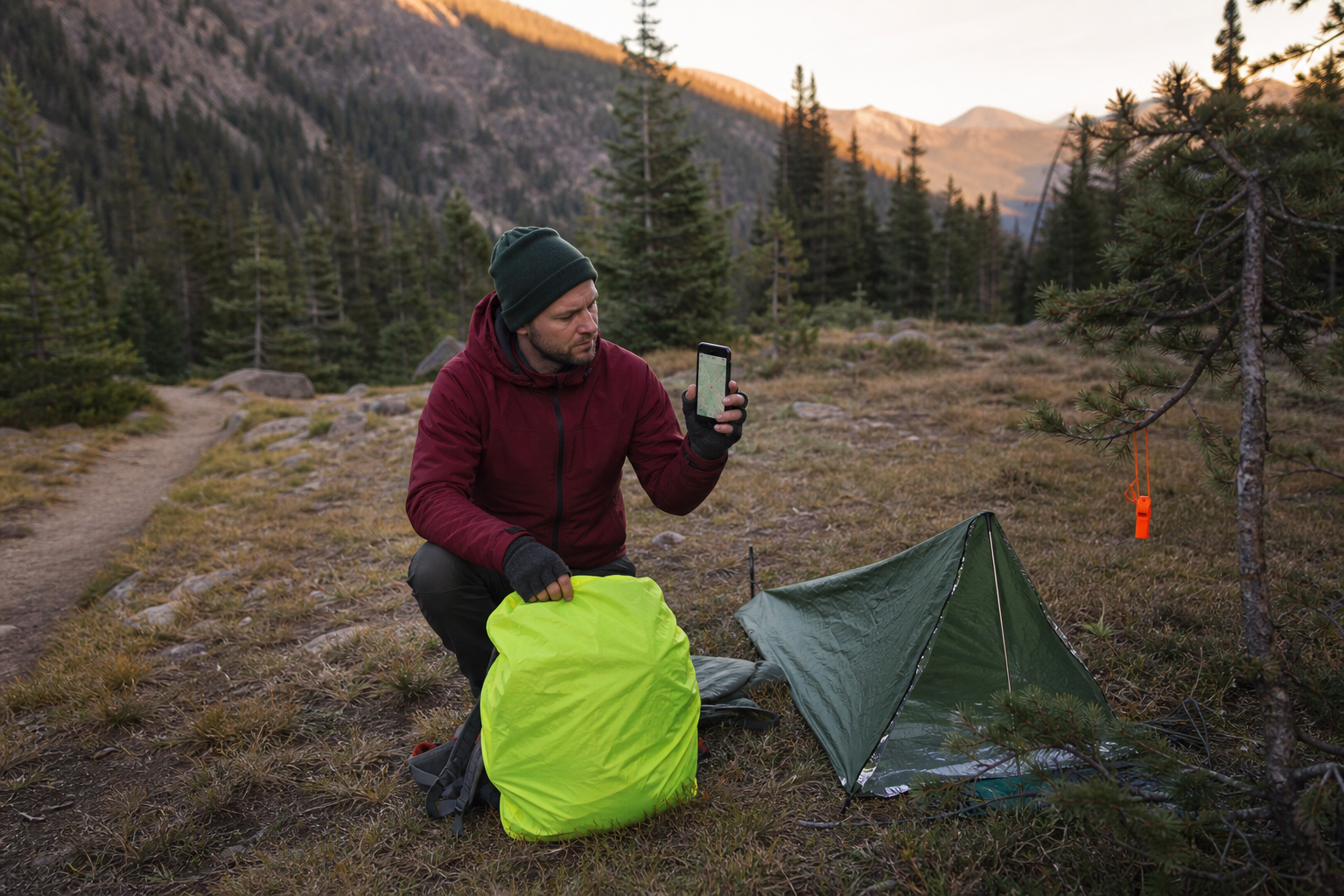
Move away from immediate hazards, put on protective layers, provide first aid, and prepare emergency shelter. Use a whistle, light, mirror, or bright clothing to make the group easier to find.
The same NPS wilderness guidance states that a signal repeated three times in a series is a recognized distress call. Pause between each series so rescuers or nearby hikers can distinguish the pattern from ordinary noise. Conserve energy and continue monitoring for a response.
FAQ
Can a Phone Make an Emergency Call Without Normal Cellular Service?
Sometimes, but it should not be assumed. A phone may connect to another available compatible network for an emergency call, yet mountains, distance, and terrain can prevent any cellular connection. Satellite emergency features also depend on the device, region, service, and view of the sky.
Is a Satellite Messenger Better Than a Personal Locator Beacon?
They serve different needs. A satellite messenger may support two-way messages, tracking, and SOS communication with an active service plan. A personal locator beacon primarily transmits a dedicated distress signal through a rescue-alert system. Choose based on the route and communication needs.
Should You Use Airplane Mode While Hiking?
Airplane mode can reduce power used while the phone repeatedly searches for a network. Confirm that offline maps and required location functions still work on your device, then briefly restore the necessary connection at planned check-in points. Do not use airplane mode if it interferes with an emergency feature you expect to rely on.
Conclusion
Hiking safety depends on preparation, communication, and timely decisions. Review the route and weather, leave an itinerary, set a turnaround time, and carry equipment that can support an unexpected delay. Download maps and key information before coverage disappears.
On the trail, monitor location, pace, daylight, weather, group condition, and remaining power. If you become lost, stop early, reassess your last known location, send clear information when possible, and remain easier for rescuers to find.
A rugged phone can strengthen a hiking communication plan, but no phone can guarantee coverage, navigation accuracy, or rescue. Combine it with practiced skills, physical navigation tools, suitable supplies, and a dedicated emergency communication option for remote routes.